
What began as a high-alert weather day in northern Illinois turned into a violent evening of tornado warnings, giant hail, and wreckage stretching from Kankakee County into northwest Indiana.
By late Tuesday, March 10, emergency crews were moving through darkened streets south of Chicago, checking damaged homes and blocked roads after a rotating supercell cut across the Kankakee River Valley.
The National Weather Service in Chicago said the storm was responsible for a family of at least 4 tornadoes across Livingston and Kankakee counties in Illinois and into Newton, Jasper, and Starke counties in Indiana.
The same storm also dropped hail from 3 inches to locally 5 inches, with a 6.0-inch hailstone reported in Kankakee that may qualify as a new Illinois state record if verified.
Table of Contents
ToggleA Forecast That Carried Real Warning
Forecasters had been signaling danger well before the first touchdown. The National Weather Service said a tornado watch was already in effect before the tornadoes formed, and tornado warnings were issued before each confirmed tornado.
The agency also noted that the Storm Prediction Center had assigned a rare Level 4 out of 5 tornado threat before storms developed, an unusually strong signal for northern Illinois in early March.
That forecast proved painfully accurate.
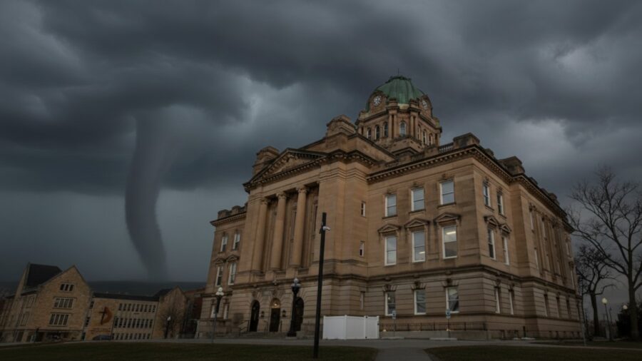
The Kankakee-area tornado became the defining image of the night. According to the weather service and Chicago-area reporting, the storm moved along the far south side of Kankakee near the airport around 6:21 p.m., crossed the Kankakee River into Aroma Park, and continued east toward Hopkins Park before pushing into Indiana.
Officials in Kankakee County described extensive damage and warned residents to stay off the roads as debris, fallen trees and downed power lines choked local travel routes.
Kankakee Took the First Hard Hit
In the hours after impact, first responders were still trying to piece together the scale of the destruction. The Chicago Sun-Times reported that police convoys and mobile command units moved through damaged areas Tuesday night, searching for injured residents and surveying the wreckage.
Sheriff Mike Downey said emergency lines were overwhelmed and urged people not to make non-emergency calls while crews worked through the immediate crisis.
The Associated Press, citing the Kankakee County Sheriff’s Office, reported that the tornado came down near the Kankakee fairgrounds before driving northeast into Aroma Park, where it caused extensive damage.
Early reports from Illinois indicated no deaths in that immediate Kankakee strike zone, but the storm was still unfolding eastward.
The Hail Was Exceptional, Even by Midwest Standards
The tornado threat alone would have made Tuesday a major weather story. What set it apart was the hail.
The National Weather Service said the same supercell that spawned the tornado family also produced exceptionally large hail, including stones ranging from 3 to 5 inches in diameter. In Kankakee, a hailstone measured at 6.0 inches was flagged as a possible new Illinois record, pending formal verification.
The previous state record, according to NWS Chicago, was 4.75 inches, set in Minooka in 2015. Another storm farther north dropped hail from 2 to nearly 5 inches across parts of the Chicago metro, including Darien, where a 4.8-inch hailstone was measured.
That means the Tribune’s pairing of tornadoes and large hail was not headline inflation. Both hazards were central to the event, and both reached rare intensity.
The Storm Did Not End at the State Line
As the supercell tracked into Indiana, the damage worsened. The Associated Press reported that 2 people were killed in Indiana as the storms tore through communities, leveling homes, downing power lines, and forcing rescue efforts in hard-hit areas such as Lake Village.
The broader storm corridor turned what began as a regional Illinois emergency into a multi-state disaster zone by Wednesday morning.
By then, the National Weather Service had made clear that the March 10 outbreak was still being analyzed and that its event page remained under construction while survey teams worked to determine the exact strength and full number of tornadoes. That caveat matters.
Early storm stories often change as survey crews trace damage paths and refine ratings. But the central facts are already established: multiple tornadoes, destructive impact in Kankakee County, a giant hail of potentially record-setting size, and a deadly continuation into Indiana.
A Night the Region Will Not Quickly Forget
For much of the Chicago area, severe weather usually means brief warnings, heavy rain, and maybe some wind damage. Tuesday was something else.
In Kankakee County, residents watched a storm turn from forecast risk into a live emergency, with flashing lights, blocked roads, and homes torn open under a darkening sky. Official surveys will finish the technical record in the days ahead.
The emotional record was written Tuesday night, in the sound of sirens, the crush of hail, and the sudden recognition that one supercell had changed entire neighborhoods in a matter of minutes.
Related Posts:
- The 100 Most Dangerous Cities in America (2026):…
- Safest Cities in California in 2026: An Honest,…
- 25 Most Dangerous Cities in US - Updated Statistics for 2026
- Best Places to Retire Abroad in 2026: An Honest,…
- America’s Murder Capitals - Updated 2026 Rankings of…
- 12 Worst Neighborhoods in Chicago - Dangerous Places…