
In much of the U.S., walking or biking is basically a gamble. In 2022 alone, cars killed 7,522 pedestrians and close to 1,000 cyclists – up 75% since 2010, Smart Growth America reported.
It’s not just bad drivers. Our roads were built like racetracks: wide, fast, and almost allergic to sidewalks. A few stretches are practically death traps, and calling them “transportation infrastructure” is generous.
1. US-19, Pasco County, Florida
View this post on Instagram
US-19 is infamous among traffic safety experts and local residents alike. Stretching along Florida’s Gulf Coast through Hudson, Port Richey, New Port Richey, and Holiday, it has earned the grim nickname “death valley.”
Design and Conditions
The highway roars with three lanes each way, ballooning to nine at big intersections. Cars fly past 60 mph on “45” signs, crosswalks are a rumor, and bike lanes? Forget it.
Fatality Statistics
US-19 is basically a death trap. Between 2001 and 2016, 137 people were hit and killed walking there, as per reports.
By mid-2022, another 48 were gone. That’s about 34 deaths per 100 miles, since 2017 alone. If tragedy strikes, bicycle accident lawyers are often the only map through the mess that follows.
Why It’s So Dangerous
US-19 is a textbook example of a “stroad,” a hybrid of street and road that invites both local activity and highway speeds. Pedestrians and cyclists are forced to contend with fast, heavy traffic without safe refuge.
Florida keeps its grim title as a pedestrian death trap, with 899 lives lost in 2022. Wide highways like US‑19 force people to gamble their lives just to cross the street.
2. Overseas Highway (US Route 1), Florida Keys
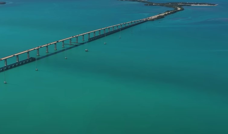
The Overseas Highway may serve up postcard views from Miami to Key West, but step outside your car and it’s basically a death trap.
Design and Conditions
Narrow lanes, frequent potholes, and a near-total lack of shoulders make walking or cycling hazardous.
On long bridge spans, there is often no barrier between a cyclist and vehicles speeding past at 50 mph or more.
Deadly Reputation
This highway racks up fatal crashes every year, often courtesy of lost tourists who never saw it coming.
Why It’s a Dangerous
Pitch-black nights, no shoulder to speak of, and zero love for walkers or cyclists. Slip up here and help might take its sweet time to find you.
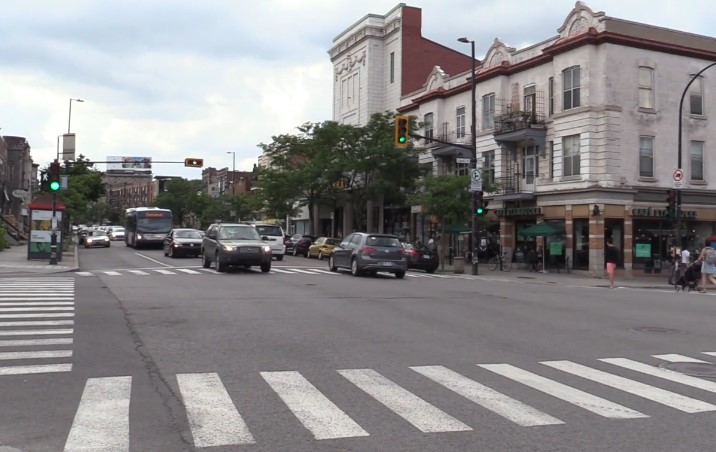
3. Hempstead Turnpike, Long Island, New York
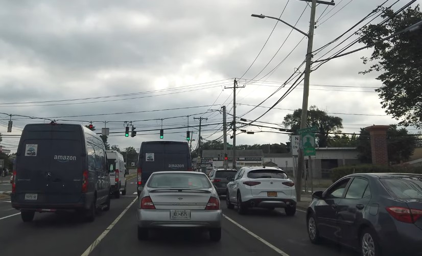
Hempstead Turnpike in Long Island proves you don’t need the middle of nowhere to be in danger.
This busy commercial artery has become notorious for cyclist fatalities and serious crashes.
Design and Conditions
The road is wide, congested, and devoid of protected bike lanes. Cyclists are often forced to ride alongside aggressive traffic.
Fatality Statistics
In 2019, 93 crashes were reported along the turnpike, with multiple involving cyclists. One tragic incident that year was the death of 13-year-old Andrew Alati, who was struck while crossing the road on his bike (per Bicycling).
Why It’s So Dangerous
Cars rip through this strip like it’s a racetrack, while pedestrians and cyclists play daily roulette. No bike lanes, barely any safe crossings. Roads like Hempstead Turnpike prove suburbs were built for speed, not people.
4. White Plains Road & East Gun Hill Road, Bronx, New York
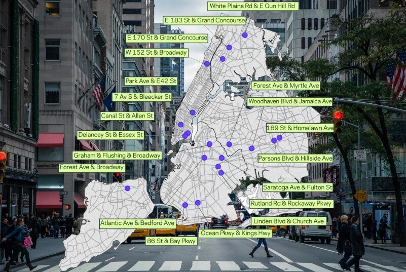
Intersections can kill too. Just take a look at what’s going on at White Plains and East Gun Hill in the Bronx.
Design and Conditions
Wide lanes, heavy traffic, and poor visibility under an elevated subway line create a perfect storm. Drivers struggle to see pedestrians, and crossing the street can feel like threading a needle.
Fatality Statistics
In 2010, six pedestrian crashes were reported at this intersection. According to the NYC report, in 2016, a 61-year-old woman was struck and killed in a hit-and-run while in the crosswalk, even after the city had installed countdown signals and narrowed some lanes.
Why It’s So Dangerous
Pedestrians are left exposed in the middle of multiple lanes, often with limited crossing time. Gridlock and impatient drivers only worsen the risk.
5. East Fordham Road & Webster Avenue, Bronx, New York
Just a short distance from the previous intersection, East Fordham Road and Webster Avenue offers a similar cautionary tale about urban design.
Design and Conditions
The intersection spans 70 feet across and serves as a major shopping hub. There is no median refuge for pedestrians, meaning those caught mid-crossing are fully exposed to oncoming traffic.
Fatality Statistics
Detailed yearly numbers are scarce, but crashes are frequent, and the intersection’s configuration has long been flagged as hazardous.
Why It’s So Dangerous
Crossing times are often insufficient for slower walkers, and heavy vehicle congestion tempts some pedestrians to weave between cars. It is a clear example of how traffic engineering can fail real-world users.
Quick Reference Table of Deadliest Roads
| Road/Intersection | Location | Key Dangers | Fatality Statistics | Source |
|---|---|---|---|---|
| US-19 | Pasco County, FL | High speeds, few crosswalks, wide lanes | 137 deaths (2001–2016), 48 more (2017–2022) | Vox |
| Overseas Highway (US 1) | Florida Keys, FL | No shoulders, potholes, heavy traffic | Multiple fatal crashes annually | Jack Bernstein Injury Law |
| Hempstead Turnpike | Long Island, NY | Heavy traffic, no bike lanes | 93 crashes in 2019, multiple cyclist deaths | Bicycling |
| White Plains Rd & East Gun Hill Rd | Bronx, NY | Poor visibility, wide roadway | 6 pedestrian crashes in 2010, 1 death in 2016 | SoBo Law |
| East Fordham Rd & Webster Ave | Bronx, NY | Wide intersection, no median, gridlock | Frequent pedestrian accidents | SoBo Law |
Why These Roads Are So Deadly
Though they span different landscapes, from Florida’s coastal highways to New York’s city streets, the deadliest roads for pedestrians and cyclists share some clear traits:
1. Speed Kills
Hit someone at 40 mph and there’s a three-in-four chance they won’t walk away. Physics doesn’t negotiate.
2. No Sidewalks, Huge Problems
No crosswalks, bike lanes, or medians? Pedestrians are instantly vulnerable.
3. Wide Roadways
Wide intersections and extra lanes just mean pedestrians spend longer in traffic, giving drivers more chances to hit someone.
4. Poor Visibility
Obstacles like elevated tracks, poor lighting, or blind curves increase the chance of drivers not seeing someone in time.
5. Heavy Traffic Volumes
More cars mean more opportunities for conflict, particularly in commercial corridors and tourist routes.
6. Vehicle Size
The rise of SUVs and trucks plays a role too. Heavier, taller vehicles are 50–100% more likely to kill a pedestrian on impact than smaller cars.
Who’s in the Crosshairs
Dangerous roads don’t hit everyone equally.
- The South: Florida and Texas practically own the top of the death charts. Nine of the 20 deadliest metro areas for walkers are in Florida alone.
- Poor Neighborhoods: Three out of four fatal stretches run through low-income areas with the usual setup – missing sidewalks, dark streets, and no safe crossings.
- Minority Communities: Black pedestrians die twice as often as white pedestrians. Native Americans, nearly three times. The roads just mirror decades of neglect.
- Older Adults: Anyone over 50 moves slower, reacts slower, and drivers don’t wait. The risk spikes after 75.
Efforts to Make Roads Safer
Cities keep promising safer streets, but progress crawls.
- Vision Zero: Boston and D.C. swear they’ll end traffic deaths. Their big moves? Slower speed limits, a few crosswalks, and fixing the scariest intersections.
- Infrastructure tweaks: Bike lanes with actual protection, islands for pedestrians to hide on, and LED lights. The feds even threw $5 billion at “road safety” in 2022.
- Policy and policing: Speed cameras and bigger fines for drivers glued to their phones. Police occasionally patrol the danger zones.
- Local pressure: Residents still do the heavy lifting, begging for changes while dodging cars.
Staying Alive and Safe 101 for Pedestrians and Cyclists
The streets aren’t built for you, so survival takes a little strategy:
- Cross where cars expect you, or gamble elsewhere at your own risk.
- No sidewalk? Walk facing traffic and hope they see you first.
- Glow at night. Reflective gear isn’t a fashion statement, it’s a lifeline.
- Eyes up, ears open. Your playlist can wait.
- Pick streets where drivers aren’t pretending to be in a video game.
Summary
America’s killer roads aren’t an accident. They were designed to move cars fast and treat people like obstacles – just look at US‑19, the Overseas Highway, Hempstead Turnpike, or half the Bronx.
Staying alert won’t save you. Only slower speeds, real bike and foot space, and rules that bite will. Cities that fix that don’t just drop the death toll, they make streets people actually trust.