Skip to content
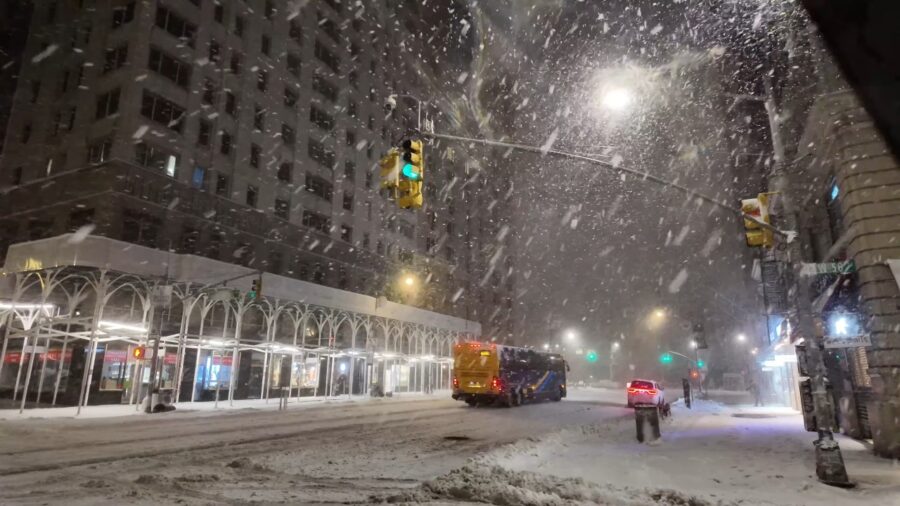

A fast deepening winter storm drove blizzard warnings across the Northeast on Monday, dumping heavy snow in intense bands and pairing it with strong winds that repeatedly erased visibility on roads and runways.
Officials responded with travel bans, school closures, and emergency declarations as the storm tightened its grip on the most densely traveled corridor in the country.
Table of Contents
ToggleTravel Bans and Emergency Orders Took the Lead
In New York City, Mayor Zohran Mamdani declared a local state of emergency and imposed restrictions on non-essential travel as the storm approached, a move city officials framed as a way to keep roads clear for emergency vehicles and snow operations.
Reuters reported that the city’s restriction covered non-essential vehicular traffic, including bicycles and scooters, during the overnight peak into midday Monday.
Across the region, similar measures followed. The storm’s footprint stretched far beyond city limits, and emergency declarations and advisories rippled through multiple states as conditions deteriorated from Sunday night into Monday.
Airports and Rail Networks Buckled Under the Volume
Air travel took a direct hit. Associated Press reported more than 5,000 flight cancellations tied to the storm, with the heaviest disruption clustered around the New York and Boston metro areas.
On Sunday alone, Reuters counted thousands of cancellations and more than 15,000 delays by early afternoon, with some of the largest cancellation totals at the airports that anchor the region’s flight map: John F. Kennedy International Airport, LaGuardia Airport, and Newark Liberty International Airport.
On the ground, commuter rail and bus service also faltered. Reuters reported that NJ Transit suspended service statewide as the blizzard warning expanded and travel conditions worsened.
Snowfall Rates and Wind Combined Into True Blizzard Conditions
The defining feature was not only total accumulation, it was the pace. AP described snowfall rates reaching 2 to 3 inches per hour in some areas, the kind of rate that can bury plowed lanes almost as quickly as they are cleared.
Winds then did the rest. When gusts push loose snow across open roads and bridges, visibility collapses, and it stops mattering whether the snow falling from the sky is moderate or heavy. Drivers lose lane markers, plows lose their reference points, and crashes turn minor backups into closed highways.
The National Weather Service blizzard warning definition is built for that combination: visibility reduced to 1/4 mile or less for at least 3 hours, alongside sustained winds of 35 mph or frequent gusts to 35 mph or greater.
Power Outages Climbed as Crews Fought Wind and Ice
As the storm intensified, outages spread. AP reported more than 400,000 customers without power, with Massachusetts and New Jersey among the hardest hit.
The Washington Post put the outage total higher, around 500,000, and described the storm’s winds as strong enough in coastal areas to resemble lower category hurricane force gusts, with some gusts reaching about 80 mph.
For utilities, wind is often the multiplier. Crews can clear lines and restore neighborhoods faster after a simple heavy snow event than they can after a wind driven storm that drops trees onto feeders, breaks poles, and keeps bucket trucks grounded.
Why Forecasters Kept Using the Term “Bombogenesis”
Forecasters and media coverage repeatedly referenced “bomb cyclone” or “bombogenesis” as the system strengthened offshore. The term has a technical meaning: rapid intensification of a mid latitude cyclone over a 24 hour period, measured by a steep pressure drop that varies by latitude.
The reason it matters operationally is straightforward. Rapid deepening tightens the pressure gradient, which usually means stronger winds, more violent blowing snow, and a longer window where travel becomes dangerous even for professional operators.
AP cited the National Weather Service calling the storm a “classic bomb cyclone” nor’easter setup.
A Storm Measured in Shutdowns, Not Just Inches
The impact list read like a checklist of what happens when the Northeast’s core transportation spine loses traction:
- NYC Travel ban that kept non-essential vehicles off major city streets and highways
- Mass flight cancellations and cascading delays across hub airports
- Transit suspensions that stranded commuters and shifted the burden onto emergency crews
- Widespread outages as wind and snow damaged distribution lines
In practical terms, the storm’s most immediate effect was to force people off the roads and out of the air, while government agencies tried to keep a limited number of routes open for ambulances, plows, and utility response.
What Officials Were Watching as the Storm Moved Through
Reporting from The Guardian, drawing on AP coverage, described expectations that snow would taper later Monday, while warning that cleanup and restoration could take longer than the storm itself.
The near term focus for emergency managers typically narrows to a few questions: when winds ease enough for full utility restoration work, whether secondary flooding develops along exposed coasts, and how quickly critical arteries can be reopened without triggering preventable crashes.
Even after snowfall rates slow, the most dangerous window can linger, especially if gusts keep pushing snow back onto cleared pavement and temperatures drop enough to turn slush into ice.
Related Posts:
- Safest Countries in the World in 2025 - GPI…
- 25 Most Dangerous Cities in US - Updated Statistics for 2026
- Commercial Responsibility for Slip and Fall Claims…
- Capital Cities in Europe: Top Destinations For You…
- 13 Most Dangerous Neighborhoods in New York 2026 -…
- 13 Richest Cities in the US 2026 - Luxury, Money,…